Trekking towards the Torfajökull icecap, Iceland #3 |
This is the third section of an illustrated diary of a trek around the Torfajökull [Torfajokull] icecap in 1996. Torfajökull is around 10km north of the northern edge of Myrdalsjökull [Myrdalsjokull], in the southern region of Iceland.
This diary is now organized as four pages: page 1 | page 2 | page 3 | page 4 |
| |
| |
 |
 |
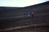
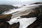
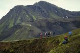
Day 5 dawns cold and dull, appropriate weather for the wild and lifeless landscape as we leave Laufafell. Snow is still lying, and the shapes are fantastic. |
 |
 |
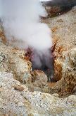 |
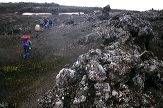
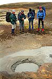
| We walk across a wild plain covered in great dollops of lava, and marvel at a grey, sulphurous hot-pot with its strange, slurpy, bubbling noises. Eventually we arrive at 'the Door to Hell' – the picture on the right shows me standing there in the steam, listening to an almost mechanical humming noise from the depths of the earth. Maybe there was someone working down there... |
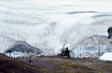 |
A small detour takes us to some ice caves, hollowed out by volcanic activity under the glacier – the same process, on a much smaller scale, that caused problems with Vatnajökull in October 1996, just two months after our trek. |
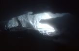 |
After walking around in the mist inside the cave for some time, and trying to get an impression of the size of it in the darkness (it seemed huge) I wonder why there are some large ice blocks lying on the ground, and decide to leave... |
 |
 |
Climbing higher, the landscape now loses its colour and turns to a monochrome composition of black ash and white packed snow. |
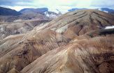 |
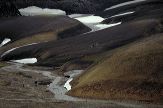
Towards the end of a long and strenuous day (at least, we thought it was nearly the end!) in conditions much darker than this picture suggests, we found ourselves looking down on this magnificent Ryolite landscape. Laid down by volcanic activity, it has been eroded by water from rain and snow-melt into these wonderful patterns. |
 |
 |
 |
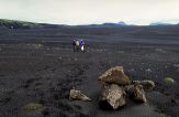
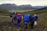
| Day 6 finds us really in the wilds, walking across a long, ashy 'black desert', which turned eventually into a hilly landscape where pale geen moss tries hard to survive and adds a wash of colour to the black mountains. The morning weather is dull and drizzly, the closest we get to rain in the entire trek. |
 |
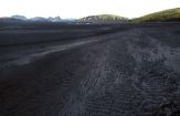
Looking across the Hólmsarbotnar valley to our home for the next 3 nights – the hut at Strutslaug. It is visible in this picture, but only if you know where to look (and I'm not giving away the secret!) By spending 2 full days in the area we will have more chance of good weather for our walk across the ice of Torfajökull, the climax of the trek. |
| < previous | page 1 | page 2 | page 3 | page 4 | next > |
|