Trekking towards the Torfajökull icecap, Iceland #2 |
This is the second section of an illustrated diary of a trek around the Torfajökull [Torfajokull] icecap in 1996. Torfajökull is around 10km north of the northern edge of Myrdalsjökull [Myrdalsjokull], in the southern region of Iceland.
This diary is now organized as four pages: page 1 | page 2 | page 3 | page 4 |
| |
| |
 |
 |
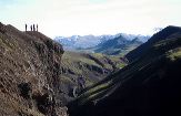
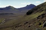
It didn't rain. Day 3 dawns bright and sunny, and we start out with superb views across the ashy landscape. |
 |
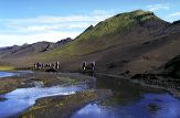 |
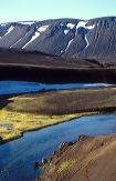
For a while we follow the banks of the Markarfljót River... |
 |
 |
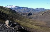
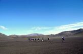
... but soon come to the first of the 'black deserts'. It's a lot further than it looks in the clear air. |
 |
 |
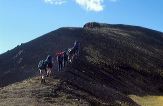
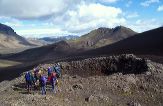
The group inspects a small and long extinct volcanic crater. |
 |
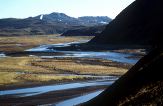 |
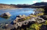
Views over the Markarfljót river from our third hut at Laufafell show incredible contrast in the clear Icelandic air. We will be staying here for two nights, so tomorrow is a rest day. |
 |
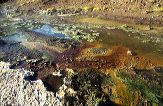 |
At the edge of the Markarfljót river we are fascinated by the minerals and plant life around a small hot spring. |
 |
|
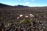
Most of us go in different directions on our rest day – yet another day of sunshine. I find this lone flower, just 7cm high, trying to survive in the barren landscape. The 'soil' is actually a layer of dead moss, and very good to walk on. |
 |
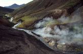 |
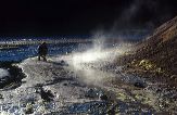
Down by the river, a picture postcard view. Three of us cross the river to check out a plume of steam rising in the still air, and find our first real hot spring – a furiously boiling, sulphurous pool. |
| < previous | page 1 | page 2 | page 3 | page 4 | next > |
|